Tag: weather

  • Thunderstorms and Hail Forecast for Cyprus Amid Unsettled Weather

    Thunderstorms and Hail Forecast for Cyprus Amid Unsettled Weather

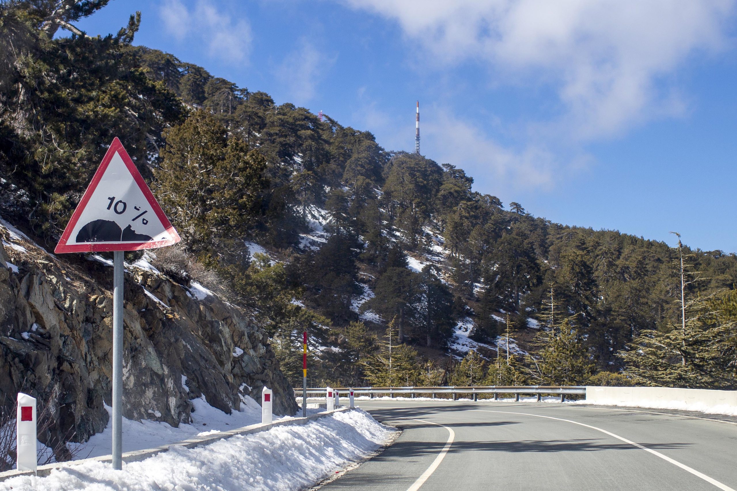
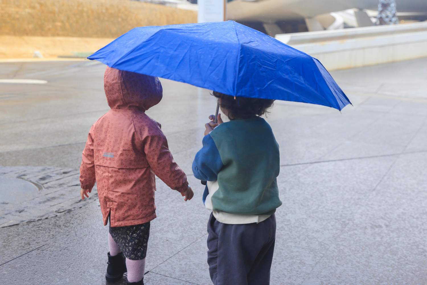
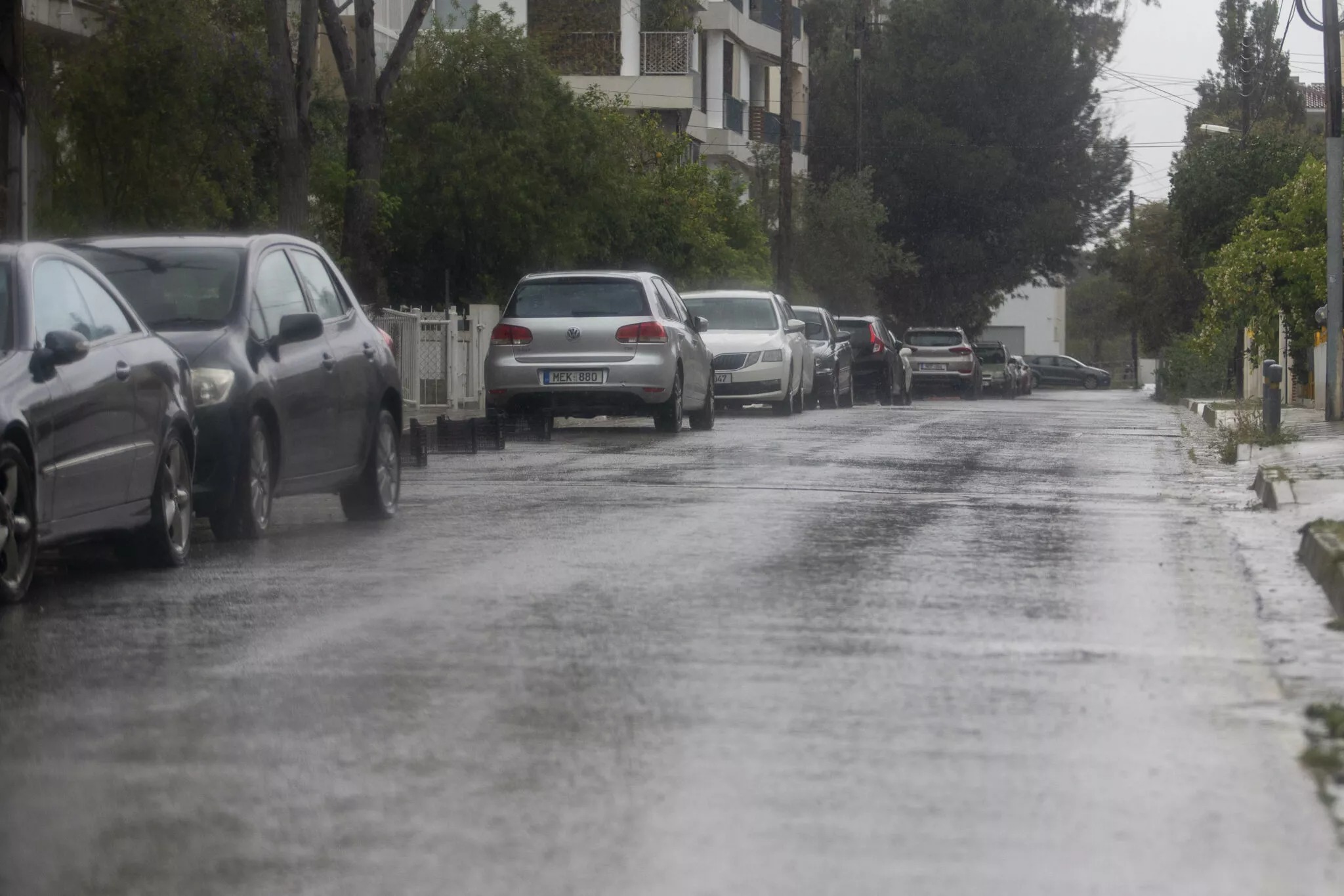
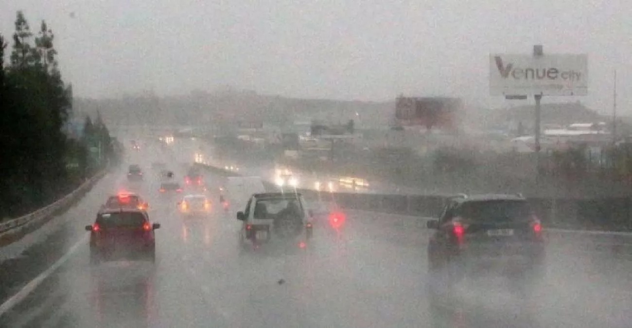
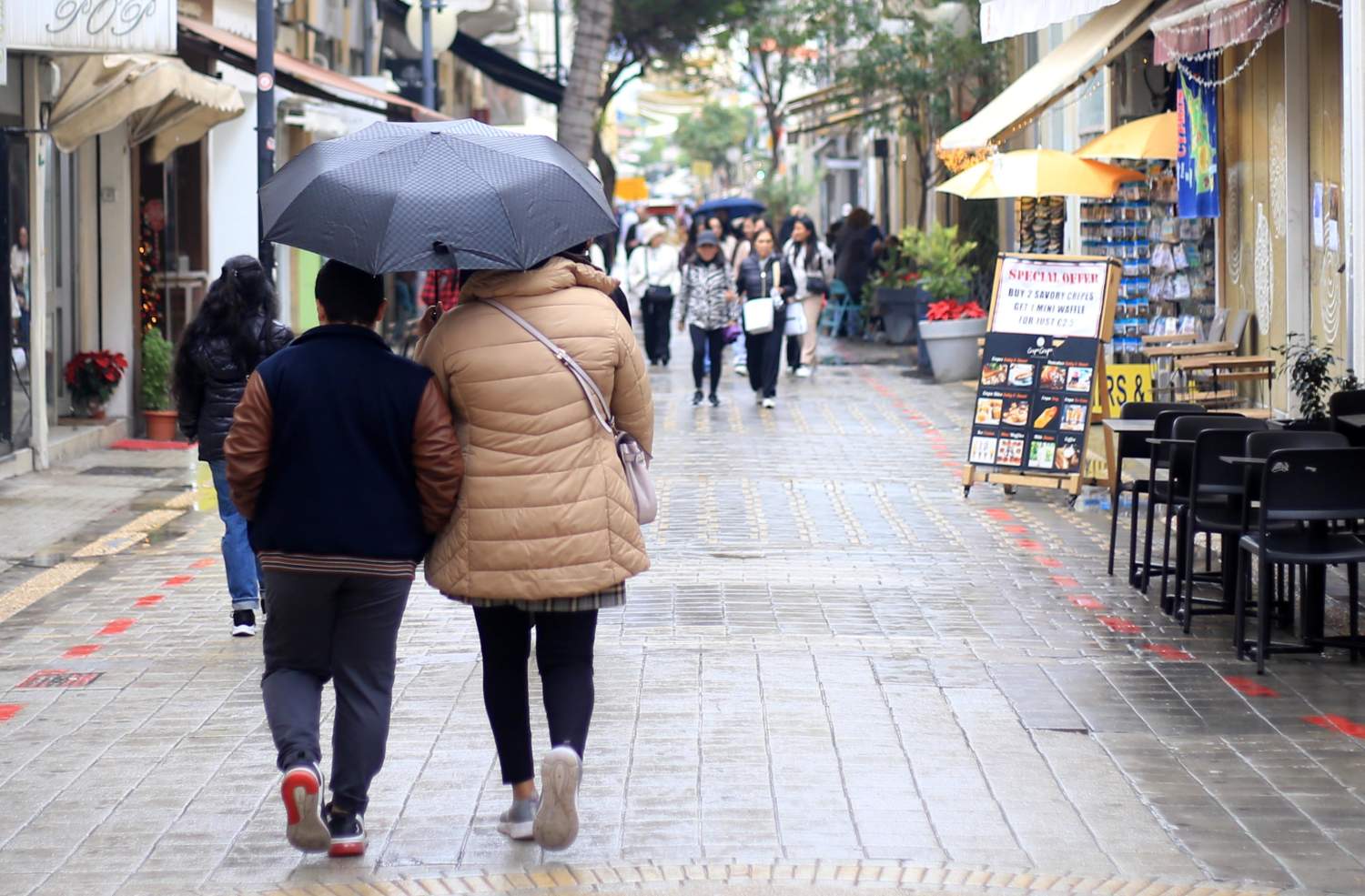
    Cyprus is bracing for thunderstorms and hail as unsettled weather grips the island. On Wednesday, mainly cloudy conditions will dominate the skies, with local rain expected at intervals and isolated thunderstorms likely to occur. Hail may accompany these storms, while the higher mountains anticipate snow or sleet.

    • This shift in weather patterns signals a notable change for the island, with residents advised to prepare for possible disruptions due to the thunderstorms and hail.

    Thunderstorms: Wind Patterns and Sea Conditions

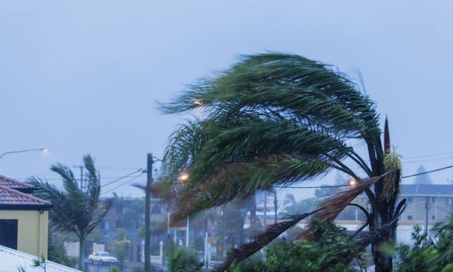
    Winds will initially blow from the southeast to southwest in the morning, classified as light to moderate at 3 to 4 Beaufort. As the day progresses, these winds will gradually shift to a southwest to northwest direction, maintaining the same intensity. Coastal areas in the southwest, west, and north will experience temporary gusts, escalating to moderate to strong winds of 4 to 5 Beaufort.

    Temperature Expectations

    As for temperatures, they are projected to reach approximately 15°C inland and 16°C along the coast, with the higher mountains seeing a drop to around 6°C. The evening will continue to see mainly cloudy skies, with isolated rain primarily affecting the west and north coasts. Winds in the evening will also shift to southwest and northwest, remaining light to moderate.

    Forecast for the Coming Days

    Looking ahead to Thursday, the island can expect similar weather conditions, with mainly cloudy skies and the possibility of isolated thunderstorms. Hail may again fall during storms, and snow or sleet is anticipated in the higher elevations. The forecast for Friday and Saturday suggests a continuation of cloudy skies with local rain and isolated thunderstorms, as well as the potential for hail and further snowfall in elevated areas.

    Increasing Winds and Temperature Trends

    On Saturday, Cyprus will experience strong to very strong winds from the southwest, which may affect outdoor activities and travel. However, temperatures are projected to rise gradually, moving closer to and slightly above the seasonal average as the weekend progresses.

    This shift in weather patterns signals a notable change for the island, with residents advised to prepare for possible disruptions due to the thunderstorms and hail.

  • Storm warning: Met Department Alerts Cyprus of Storms and Mountain Snowfall

    Storm warning: Met Department Alerts Cyprus of Storms and Mountain Snowfall

    storm warning — storm warning — The Met Department has issued a warning about unstable weather conditions across Cyprus, with isolated thunderstorms and snowfall expected on the highest peaks. This weather pattern will persist until Thursday, affecting daily life and outdoor activities.

    Storm warning: Weak Low-Pressure System Influences Weather

    A weak low-pressure system is responsible for the impending weather changes. Starting today, the region will experience increasingly cloudy skies as the system moves in. Initially, Tuesday will begin with isolated showers, primarily concentrated in the northern and western parts of the island.

    Forecasted Conditions for Tuesday

    As the day progresses, conditions are expected to deteriorate. By the evening, local rain and isolated thunderstorms are likely to develop, bringing the potential for snow or sleet on the highest reaches of the Troodos mountains. These mountain areas are forecasted to see the most significant winter weather.

    Wind and Temperature Expectations

    Winds are predicted to strengthen in the afternoon, blowing from the southwest at four to five Beaufort. This increase in wind speed will contribute to changes in sea conditions, with the sea state expected to transition from slight to moderate.

    Temperature levels are another aspect of the forecast. Inland areas will experience maximum temperatures reaching around 16°C, while coastal regions may see a slightly higher maximum of 17°C. However, temperatures in the higher mountains are anticipated to struggle to exceed 7°C, presenting a stark contrast to the milder conditions elsewhere on the island.

    Wednesday’s Continued Unsettled Weather

    The unsettled weather pattern will continue into Wednesday. Forecasters report that further showers are likely, accompanied by a slight drop in temperatures as the low-pressure system remains in the area. Residents are advised to prepare for challenging conditions, particularly in elevated regions.

    Gradual Recovery Expected by Friday

    Despite the challenging weather conditions this week, the Department of Meteorology has indicated that a gradual improvement is expected by Friday. Temperatures are projected to rise slightly above the seasonal average for late January, offering some relief from the current instability.

    Advice for Residents and Visitors

    • Stay updated with local weather forecasts and alerts from the Department of Meteorology.
    • Prepare for potential travel disruptions, especially in mountainous areas due to snowfall.
    • Exercise caution during thunderstorms and heavy rain.

    Looking Ahead: Long-Term Weather Patterns

    While this week’s weather will be marked by instability, it is essential to consider the longer-term outlook. According to the Met Department, the region may experience heavy rain over the coming three weeks, indicating that residents should stay attentive to further forecasts.

    As weather patterns evolve, the Department will continue to provide updates, allowing residents and visitors to plan accordingly. With winter still in full swing, the potential for further storms and cold weather remains a significant aspect of life in Cyprus during this season.

  • Rain and — Cyprus Faces Rain and Mountain Snow as Temperatures Drop

    Rain and — Cyprus Faces Rain and Mountain Snow as Temperatures Drop

    Cyprus will experience rain and mountain snow as temperatures drop this weekend. On Saturday, the island is set to be mainly cloudy, with local rain and a chance of brief isolated thunderstorms occurring primarily after midday. The Troodos mountain range is expected to see sleet or snow, adding a wintry touch to the landscape.

    The winds will start off variable and light at 3 Beaufort, but are forecasted to shift to a mainly north-easterly direction later in the afternoon, increasing to light to moderate speeds of 3-4 Beaufort. This change in wind might bring a slight chill to the air, particularly as temperatures begin to decline.

    In terms of temperatures, the inland areas will reach around 15°C, while coastal regions are expected to see slightly warmer conditions at around 18°C. However, the higher elevations will be considerably colder, with temperatures dropping to about 5°C. Such variability highlights the diverse climate conditions across the island.

    Looking ahead to Sunday, rain is anticipated along with the possibility of snow or sleet in the higher mountains, further complicating the weather situation. As the weekend progresses into Monday, increased cloud cover is expected, particularly in the mountains and the southern regions of Troodos, which may bring isolated rain showers.

    Tuesday, in contrast, is predicted to be mainly clear, offering a brief respite from the unsettled weather. The temperatures will continue to show a gradual decline until Monday, before experiencing a slight rise on Tuesday, although they will remain below the seasonal average.

    For residents and visitors, this weekend’s forecast underscores the importance of staying prepared for rapidly changing weather conditions, particularly in the mountainous areas where snow can impact travel and outdoor activities.

  • Cyprus Faces Coldest Night of Winter with Frost Warning in Place

    Cyprus Faces Coldest Night of Winter with Frost Warning in Place

    coldest night — Cyprus is bracing for its coldest night of winter, as meteorological authorities have issued a frost warning ahead of a significant drop in temperatures. On Wednesday night, mountain areas could see the mercury plummet to -3°C, while inland regions are expected to hover around 2°C.

    The Department of Meteorology has specifically alerted individuals in mountainous and semi-mountainous regions about the possibility of frost. Additionally, ice formation is likely in sheltered inland areas, making caution advisable for those travelling or spending time outdoors.

    Currently, a strong high-pressure system is in place, resulting in mostly clear skies across the island. However, this lack of cloud cover is a contributing factor to the stark decline in temperatures. Residents are urged to prepare for a chilly night as temperatures drop significantly.

    Coldest night: Upcoming Weather Changes

    The cold snap is anticipated to continue through the weekend, with a gradual transition to more unsettled weather conditions. Thursday will start off mostly clear in the morning, but clouds are expected to increase by the afternoon. Maximum temperatures will be relatively mild, reaching 15°C inland and 17°C along the coast.

    By Friday, the cloud cover will thicken further, leading to a chance of isolated showers, particularly in the mountainous areas. The weekend forecasts a shift to overcast skies with intermittent rain, especially across the western half of the island. Snow or sleet is also predicted for the highest peaks of the Troodos range, adding a wintry touch to the landscape.

    Rainfall Levels Below Average

    Despite the recent influx of colder weather, rainfall levels in Cyprus remain significantly below seasonal averages. Preliminary data from the Department of Meteorology indicates that the average rainfall for January is only 47.8 millimetres, which is a mere 47% of the typical monthly total of 102.4 millimetres.

    Since the hydrological year began on 1 October, total rainfall has reached 207 millimetres, marking 70% of the normal levels for this period. This discrepancy in rainfall raises concerns about water reserves as the dry season progresses.

    Current Snowfall Conditions

    For those keen on winter sports or simply enjoying the snow, the current snow depth at the Chionistra peak is recorded at 30 centimetres. This offers a promising opportunity for skiing and snow activities, provided that weather conditions permit.

  • Rain and Thunderstorms Set to Hit Cyprus on Friday

    Rain and Thunderstorms Set to Hit Cyprus on Friday

    Rain and thunderstorms are forecast for Cyprus on Friday, bringing a change in the weather. According to the latest predictions, mainly cloudy skies will dominate, with localised rain and isolated thunderstorms expected, particularly in the mountains and northern areas by late afternoon.

    • The sea will be generally rough, with conditions worsening to rough to very rough, particularly along the western and northern coasts.
    • Temperatures are anticipated to gradually rise until Sunday, before experiencing a slight dip on Monday, aligning closely with average climatological values for this time of year.

    Thunderstorms: Winds and Sea Conditions

    Winds will predominantly blow from the south-west to the north-west, ranging from moderate to strong, classified as Force 4-5. In some locations, winds may reach strong to very strong levels, classified as Force 5-6, and at times may even escalate to near gale conditions, peaking at Force 6-7.

    The sea will be generally rough, with conditions worsening to rough to very rough, particularly along the western and northern coasts.

    Temperature Predictions

    Temperature readings on Friday are expected to hover around 15 degrees Celsius inland and on the northern and western coasts. The remaining coastal areas may see slightly warmer temperatures of around 17 degrees, while higher mountain areas could drop to about 6 degrees.

    Weather Outlook for the Weekend

    As the weekend approaches, the forecast indicates a continuation of mainly cloudy weather with occasional local rain and potential isolated thunderstorms. There is also the possibility of hail and even snow in the higher mountains, particularly on Saturday, Sunday, and Monday.

    Temperatures are anticipated to gradually rise until Sunday, before experiencing a slight dip on Monday, aligning closely with average climatological values for this time of year.

  • Gale Force Winds Set to Strike Cyprus This Friday

    Gale Force Winds Set to Strike Cyprus This Friday

    gale force — Gale force winds are expected to batter Cyprus on Friday, as the Department of Meteorology has issued a warning for very strong southwesterly winds. The winds, reaching force 6 to 7 Beaufort, will be accompanied by gusts that could escalate to storm force 8 Beaufort.

    The warning is effective from 0800 local time on 9 January 2026 until 2200 the same day. According to meteorological officials, residents should prepare for potentially hazardous conditions, especially in coastal areas where gusts may be strongest.

    In anticipation of these severe winds, the Department has classified the hazard level as yellow, indicating that while the situation is serious, it is not yet critical. Authorities are advising individuals to secure loose items outdoors and remain vigilant, particularly when travelling.

    Wind conditions are expected to disrupt normal activities, with potential impacts on transportation and outdoor events. Local businesses, especially those operating in outdoor settings, are advised to take precautions to minimise damage.

    As the storm approaches, residents are urged to stay updated through official channels for any changes in the forecast or additional safety recommendations. Preparedness is key in ensuring safety as Cyprus braces for these powerful winds.

  • December Rainfall in Cyprus Exceeds Monthly Average

    December Rainfall in Cyprus Exceeds Monthly Average

    december rainfall — Cyprus recorded rainfall at 116% of the normal monthly average during December, according to preliminary data released by the Meteorological Service on Friday.

    • Cyprus recorded rainfall at 116% of the normal monthly average during December, according to preliminary data released by the Meteorological Service on Friday.
    • In Nicosia, the Athalassa station measured 83.3 millimetres, which is 144% of normal, while Athienou reported 88.1 millimetres, also at 144% of the average.

    The average total rainfall from 1 December until 8:00 am on 1 January reached 122.8 millimetres in the free areas of the Republic, surpassing the usual December rainfall of 105.6 millimetres. This increase in precipitation highlights a significant weather pattern affecting the region.

    December rainfall: Exceptional Rainfall Totals Across the Island

    In the context of the ongoing hydrological year, which commenced on 1 October, Cyprus has received a total of 159.2 millimetres of rain by 1 January. This figure represents 83% of the normal rainfall expected for this timeframe, which is 191.6 millimetres.

    Notable Regional Variations

    Not all areas experienced the same levels of rainfall. The Polis Chrysochous station stood out with an impressive 219.2 millimetres, translating to 220% of the normal monthly average for that specific location. Similarly, the Stavros tis Psokas area recorded 249.3 millimetres, equivalent to 154% of the expected normal.

    In Nicosia, the Athalassa station measured 83.3 millimetres, which is 144% of normal, while Athienou reported 88.1 millimetres, also at 144% of the average.

    January’s Early Rainfall

    As January began, the early indicators of rainfall have been minimal, with only 0.1 millimetres recorded between the first day of the month and 8:00 am on Friday. This stark contrast to December’s figures raises questions about the weather patterns moving forward.

  • Windy New Year’s Day Forecast as Storms Diminish

    Windy New Year’s Day Forecast as Storms Diminish

    windy new — windy new — New Year’s Day 2026 is set to be windy, with the Department of Meteorology reporting that instability will begin to subside from New Year’s Eve evening. Meteorological Officer Panagiotis Linggis provided insights into the expected weather changes.

    • As for Friday, Linggis noted that winds would diminish, particularly during the afternoon, creating a brief period of calm before the windy conditions take hold.
    • The meteorological bulletin attributes the changing weather patterns to a low-pressure system and a temporarily strengthened wind field affecting the region.

    Windy new: Storms to Fade by New Year’s Eve

    Linggis indicated that storms would persist until the evening of New Year’s Eve, primarily affecting western and northern regions. By the following morning, these storms are expected to be confined to mountainous areas and possibly the occupied territories.

    Strong Winds and Colder Temperatures Ahead

    As a colder air mass moves in on New Year’s Day, strong wind gusts are anticipated, especially in the western northern areas and windward western northwestern regions. Linggis cautioned that these winds could cause some disruptions, marking wind as the predominant weather feature rather than rain.

    Temperature Fluctuations on the Horizon

    Temperatures are forecasted to drop further on Friday before beginning to rise again on Sunday. Linggis clarified that no additional rainfall is expected until Sunday, with the wet conditions concluding on New Year’s Eve.

    A Calm Friday Before the Wind Picks Up

    As for Friday, Linggis noted that winds would diminish, particularly during the afternoon, creating a brief period of calm before the windy conditions take hold.

    Weekend Weather Outlook

    The forecast for Saturday and Sunday suggests that Levantes, or easterly winds, will make their presence felt. While clouds may gather on Saturday afternoon, the overall weather is expected to remain mostly clear without rain and with manageable winds.

    The meteorological bulletin attributes the changing weather patterns to a low-pressure system and a temporarily strengthened wind field affecting the region.

  • Yellow weather — Yellow Weather Warning Issued for Storms and Gale-Force Winds Over New Year Period

    Yellow weather — Yellow Weather Warning Issued for Storms and Gale-Force Winds Over New Year Period

    Yellow weather: Severe Weather Alert for Festive Period

    yellow weather — A yellow weather warning has been issued for storms and gale-force winds, effective from 22:00 on Tuesday, December 30, to 22:00 on December 31. The Department of Meteorology has advised residents to prepare for a challenging weather system as the island braces for heavy rain and strong winds just before New Year’s Eve.

    Forecast Details

    The forecast indicates a mixture of rain, isolated storms, and very strong winds, with localised gusts potentially reaching severe intensity, classified as force 6-7 on the Beaufort scale. The Department has highlighted that this weather system will particularly impact coastal and mountainous regions, where the effects are likely to be felt most acutely.

    Rainfall Expectations

    Rainfall totals are anticipated to exceed 55 mm within a 24-hour period in some areas. Residents in vulnerable locations should take precautions, as the combination of heavy rain and strong winds could lead to hazardous conditions, including possible flooding.

    Storm Impact and Safety Recommendations

    The Department of Meteorology recommends that individuals and businesses in affected areas prepare for the possibility of power outages and disruptions to transportation. It is advisable to secure loose outdoor items and avoid unnecessary travel during the height of the storms. Furthermore, those living in flood-prone areas should remain vigilant and keep emergency kits ready.

    Potential for Hail

    In addition to rain and wind, hail is expected during some of the storm events. This could add another layer of risk, particularly for outdoor activities and travel. Residents are urged to stay indoors during severe weather and monitor updates from local authorities.

    Ongoing Monitoring

    The Department of Meteorology will continue to monitor the situation closely and provide updates as necessary. Residents are encouraged to stay informed through official channels and heed any advisories issued by the authorities.

    Looking Ahead

    As the New Year approaches, the combination of storms and gale-force winds serves as a reminder of the unpredictable nature of winter weather. Community leaders and emergency services are on alert to respond to any incidents that may arise from this weather warning.

    With the festive season in full swing, it is crucial for the public to prioritise safety and remain informed about the evolving weather conditions. The Department of Meteorology emphasises that preparedness is key to navigating the challenges posed by severe weather.

  • Thunderstorms — Rain and Thunderstorms Expected in Northern and Mountainous Cyprus

    Thunderstorms — Rain and Thunderstorms Expected in Northern and Mountainous Cyprus

    Cyprus is expected to experience rain and thunderstorms today, particularly affecting the northern and mountainous regions. The forecast indicates partially cloudy weather alongside isolated showers.

    • Cyprus is expected to experience rain and thunderstorms today, particularly affecting the northern and mountainous regions. The forecast indicates partially cloudy weather alongside isolated showers.

    Thunderstorms: Winds and Sea Conditions

    The winds will predominantly blow from the south-west to the north-west, presenting a light to moderate intensity, registering between 3 and 4 on the Beaufort scale. Along the exposed coastlines, these winds may temporarily strengthen to a moderate 5 Beaufort. Consequently, the sea conditions are likely to be slightly choppy.

    Temperature Trends

    As for temperatures, the inland areas will see a rise to around 18 °C, while coastal regions are expected to reach approximately 20 °C. In the higher mountains, temperatures will be cooler, hovering around 10 °C.

    Forecast for Tomorrow Evening

    Looking ahead to tomorrow evening, the weather is set to remain partially cloudy. Winds will mainly come from the north-west, remaining light at 3 Beaufort, with occasional increases to a moderate 4 Beaufort in exposed areas. The sea is expected to continue being slightly choppy.