Tag: weather

  • Rain thunderstorms: Rain and Thunderstorms Forecasted to Sweep Across Cyprus This Week

    Rain thunderstorms: Rain and Thunderstorms Forecasted to Sweep Across Cyprus This Week

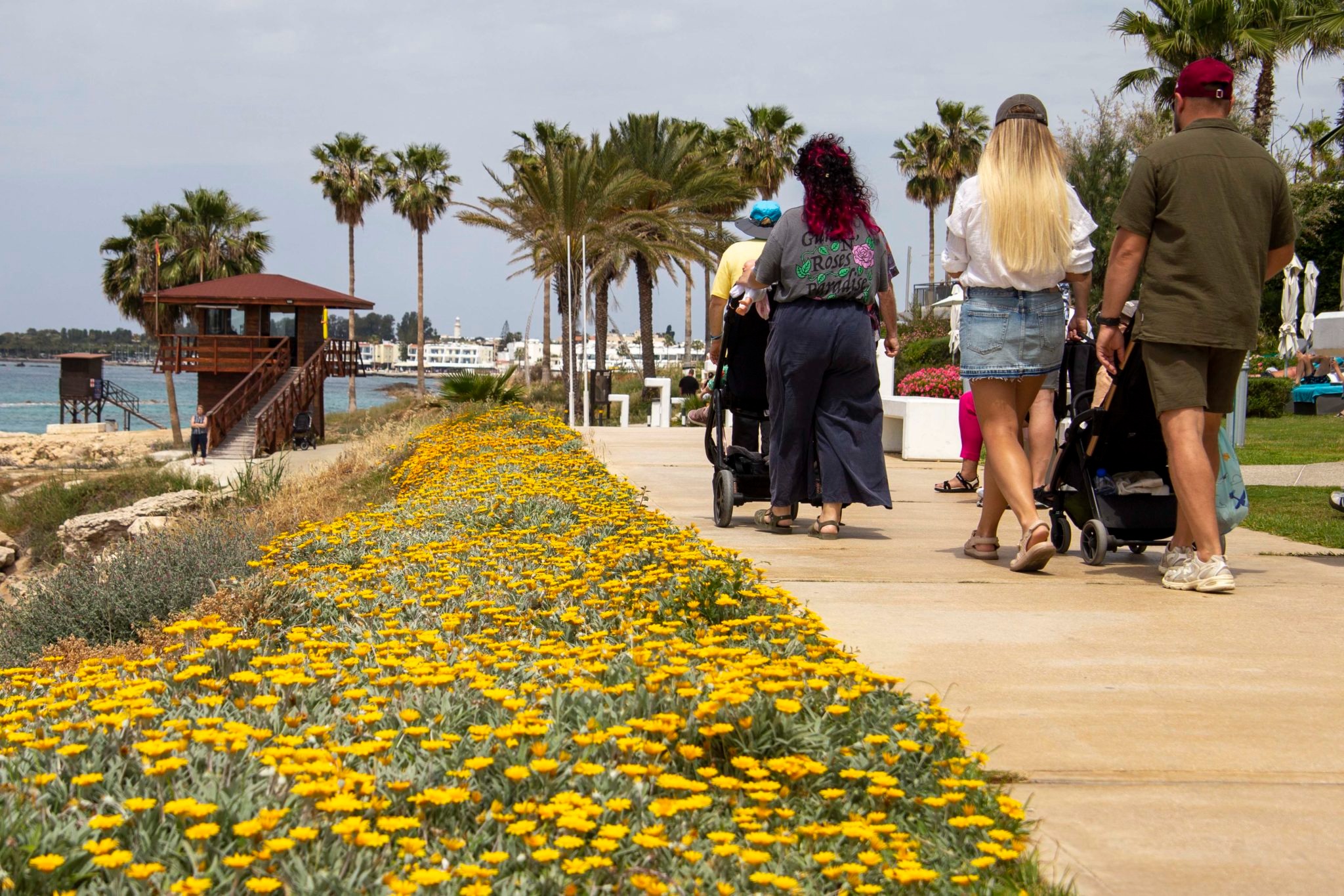
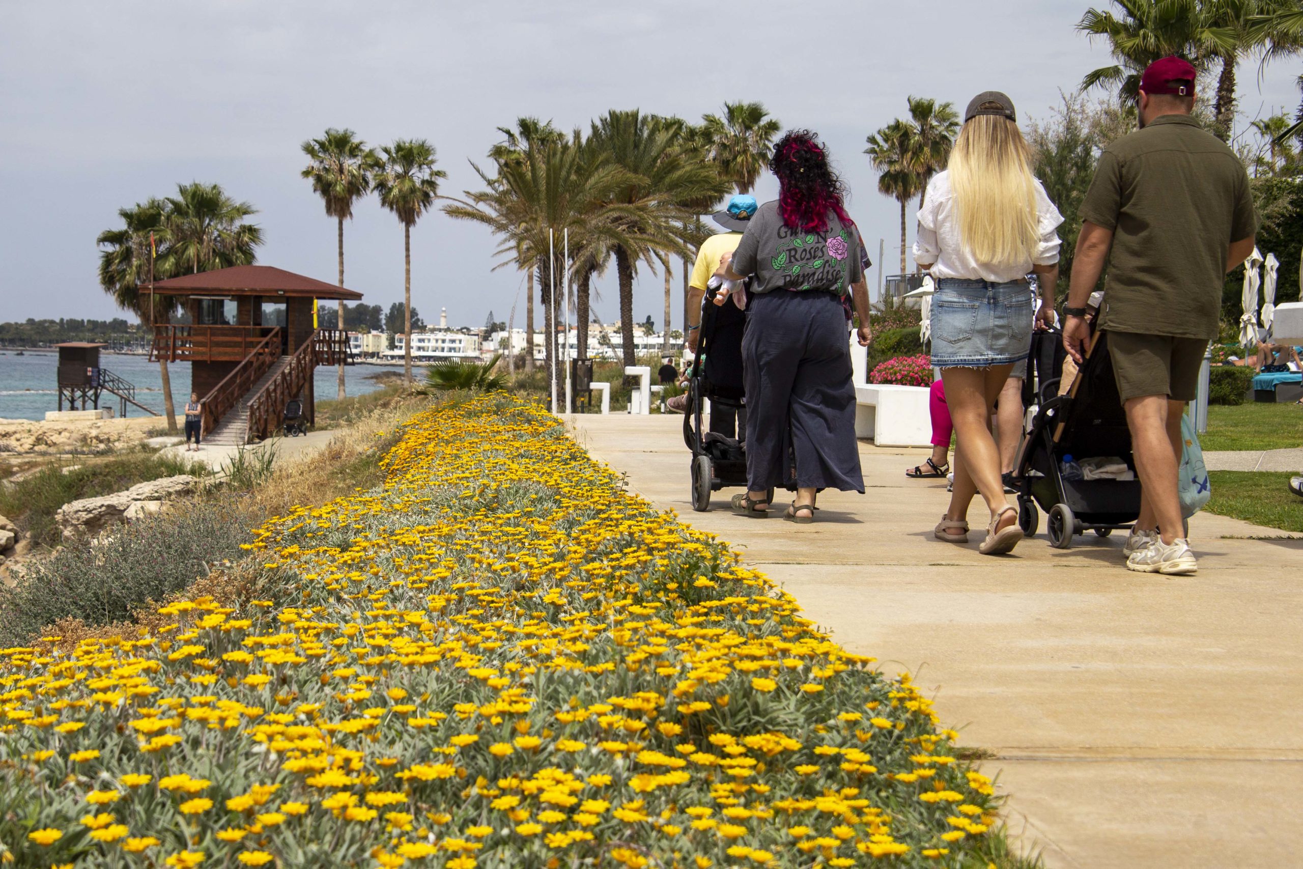
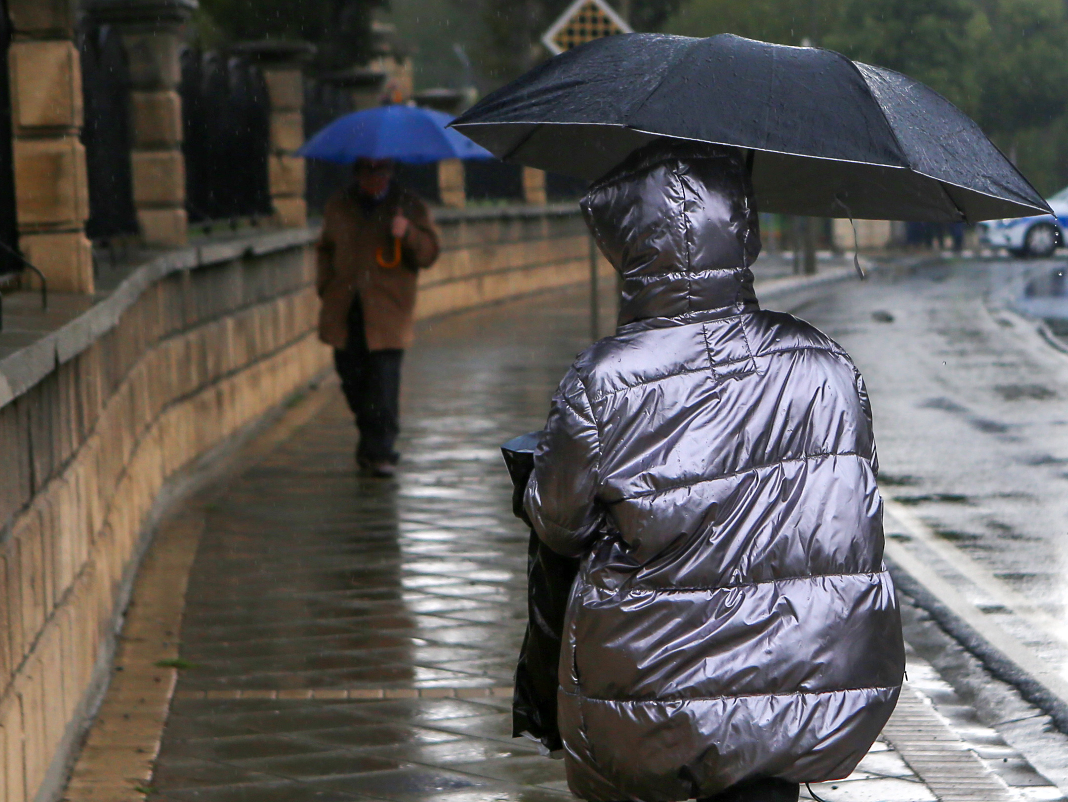
    rain thunderstorms — rain thunderstorms — Rain and thunderstorms are set to sweep Cyprus from mid-week, bringing a much-needed shift in the weather pattern across the island. According to independent forecaster Kitasweather, scattered showers and thunderstorms are expected, with temperatures gradually dropping to around normal seasonal levels by the end of the week.

    Rain thunderstorms: Weather Transition Begins on Tuesday

    On Tuesday, the weather will start partly cloudy, with high and medium cloud cover throughout the day. As the day progresses, increased cloud cover will develop, particularly in eastern and south-eastern parts of the island. Isolated showers and a chance of thunderstorms are anticipated, with rain probabilities varying between 0-30% depending on the location. Daytime temperatures will hover around 26°C in Nicosia, 25-28°C along the coast, and around 14°C in the Troodos mountains (1,900 metres).

    Midweek Showers and Thunderstorms on Wednesday

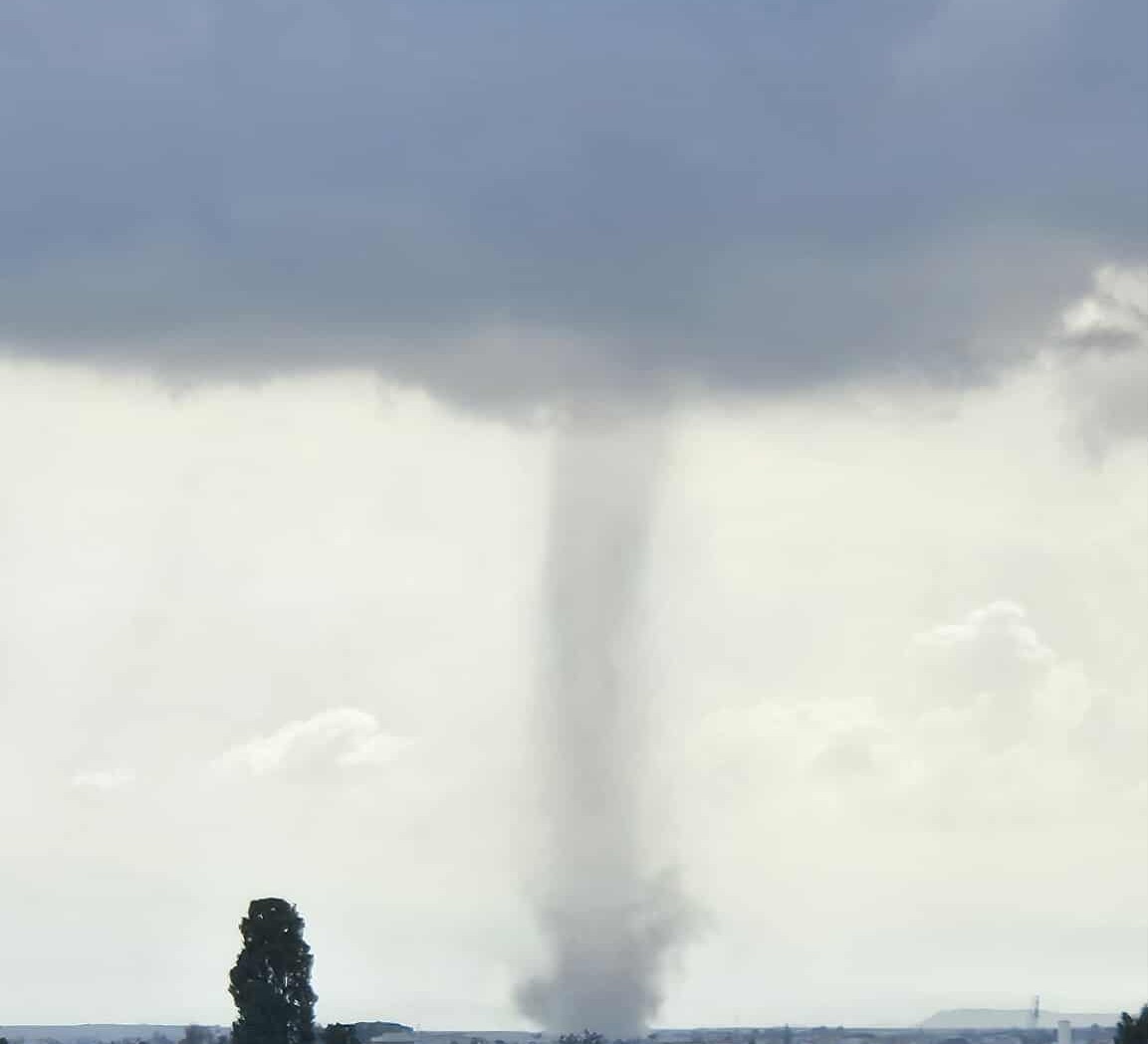
    Wednesday is expected to see a continuation of the unsettled weather. Cloud cover will increase in most areas, especially in the western and south-western parts of Cyprus, leading to isolated showers or thunderstorms. During the day, particularly in the mountainous regions and the Troodos range, localised thunderstorms may develop, with some storms potentially severe, bringing hail and gusty winds. Rain probability for the daytime ranges from 20-60%, while the evening hours may see probabilities of 25-50%. Temperatures will remain steady, around 26°C in Nicosia, 24-27°C along the coast, and approximately 12°C in Troodos.

    Continued Instability Expected on Thursday

    Thursday will mirror the previous day’s weather, starting off partly cloudy with localised cloud cover increasing, particularly along the coast. This will likely lead to isolated showers and thunderstorms, especially in the northern half of the island. As the day progresses, strong thunderstorms may develop, again accompanied by hail and gusty winds. Rain probabilities during the day will range from 30-60%, with evening probabilities climbing to between 40-60%. Temperatures will slightly decrease, settling at around 25°C in Nicosia, 23-26°C along the coast, and about 9°C in the Troodos region.

    Unsettled Conditions Continue on Friday

    As the week draws to a close, Friday’s weather will remain unsettled, with scattered showers and thunderstorms expected across the island. Some of these thunderstorms may again be strong and bring hail and gusty winds. The likelihood of rain will range from 50-70% depending on location. Temperatures will drop further, reaching around 23°C in Nicosia, 22-23°C along the coast, and approximately 8°C in Troodos.

    Weekend Weather Outlook

    Looking ahead to the weekend, Saturday is forecasted to remain unsettled with scattered showers and thunderstorms continuing. However, by Sunday, the weather is expected to ease considerably, with only a chance of isolated showers mainly during the afternoon. Saturday’s temperatures will dip slightly, settling below normal levels, while Sunday sees a slight rebound to around normal seasonal temperatures.

    Uncertainty and Recommendations for Residents

    There remains uncertainty regarding the exact path of the disturbance in the coming days, with significant changes in rain probabilities likely. Residents are advised to check forecasts at regular intervals for updates on expected rainfall and thunderstorms.

    As for the first half of next week, current data suggests a decrease in rain chances, with temperatures gradually rising back above normal levels. This week’s weather shift could provide a welcome change, particularly as Cyprus has been experiencing higher than usual temperatures in recent weeks.

    This anticipated weather change comes as the island faces challenges from climate-related issues, with organisations like the World Health Organisation (WHO) highlighting concerns about record deaths and economic losses tied to climate change in Cyprus. The upcoming rain could help mitigate some of these effects, at least temporarily.

  • Dust and — Dust and Strong Winds Affect Cyprus While Temperatures Remain Warm

    Dust and — Dust and Strong Winds Affect Cyprus While Temperatures Remain Warm

    Dust and strong winds are currently impacting Cyprus, as a weak weather system brings light dust and robust gusts across the island, according to weather officials.

    • Dust and strong winds are currently impacting Cyprus, as a weak weather system brings light dust and robust gusts across the island, according to weather officials.

    Dust and: Current Weather Conditions

    On Monday, residents can expect mostly clear skies interspersed with occasional clouds. The winds are set to blow from the southwest and northwest at speeds of 4 to 5 Beaufort, with certain areas experiencing gusts reaching 5 to 6 Beaufort. This weather pattern is expected to persist throughout the day.

    Temperature Forecast

    Temperatures are projected to vary across different regions of Cyprus. Inland areas and the southwest and north coasts are likely to see highs around 28°C, while the west coast may experience slightly cooler conditions at 26°C. The southeast and east coasts could reach up to 31°C, and mountainous regions are expected to stay cooler at around 22°C.

    Upcoming Weather Changes

    Looking ahead to Tuesday, the island will see an increase in cloud cover, with the possibility of rain or thunderstorms developing in the afternoon, particularly in the southern regions. Residents are advised to remain vigilant as weather conditions may change rapidly.

    Midweek Weather Outlook

    Wednesday is expected to start with clear skies; however, clouds will begin to build throughout the day. There is a chance of rain in mountainous areas after midday, signalling a shift in the weather pattern. By Thursday, the forecast indicates partly cloudy skies, with light rain expected in some regions.

    Temperature Trends for the Week

    As the week progresses, temperatures are set to rise slightly through Wednesday before experiencing a minor drop on Thursday. Despite these fluctuations, readings are anticipated to remain at or above the normal levels for October, providing warm conditions for the time of year.

    Weather Precautions

    In light of the strong winds and dust affecting Cyprus, authorities recommend that residents take precautions, especially those with respiratory conditions. Staying indoors during peak wind times and using air purifiers can help mitigate the effects of the dust present in the air.

    Seasonal Context

    This weather pattern is typical for this time of year in Cyprus, as the transition from summer to autumn often brings variable weather conditions. The combination of dust, strong winds, and fluctuating temperatures is consistent with previous years, making it essential for locals and visitors to remain informed about the weather.

    Monitoring the Situation

    Officials will continue to monitor the situation and provide updates as necessary. Residents are encouraged to stay tuned to local weather reports for the latest information regarding changes in weather patterns, especially as potential rain and thunderstorms approach.

  • Cyprus weather — Cyprus Weather Forecast: Fine Conditions with Temperatures Reaching 29°C

    Cyprus weather — Cyprus Weather Forecast: Fine Conditions with Temperatures Reaching 29°C

    cyprus weather — cyprus weather — The weather in Cyprus is expected to be mostly sunny, with temperatures nearing 29°C throughout Friday. Locally, there may be intermittent cloud cover, but overall conditions are favourable for outdoor activities.

    Cyprus weather: Wind Patterns and Sea Conditions

    Initially, winds will be variable and light, reaching about 3 Beaufort. As the day progresses, these winds will shift to a predominantly southwesterly to northwesterly direction, becoming light to moderate, ranging from 3 to 4 Beaufort. The sea conditions will remain smooth to slight, making it ideal for those looking to enjoy maritime activities.

    Temperature Variations Across Cyprus

    Temperature readings across the island will vary slightly based on location:

    • Inland: 29°C
    • South and East Coasts: 27°C
    • West and North Coasts: 26°C
    • Highest Mountains: 19°C

    Upcoming Weather Trends

    Looking ahead to the weekend and into Monday, residents can expect similar weather patterns with increased cloud cover at times. On Monday, there is a slight chance of isolated showers in mountainous regions, but overall, temperatures are not predicted to fluctuate significantly over the next few days. This consistency in weather aligns closely with the average climatic values for this time of year, providing a stable forecast for locals and visitors alike.

  • Clear Skies and Warm Temperatures for Cyprus This Thursday

    Clear Skies and Warm Temperatures for Cyprus This Thursday

    clear skies — Clear skies are in store for Cyprus on Thursday, with temperatures expected to reach 28°C inland. Although the day will start with mainly fine weather, some areas may experience increased cloudiness, especially after midday.

    • The sea will remain smooth to slight, making it ideal for any maritime activities or a leisurely day at the beach.

    Clear skies: Weather Conditions Across Cyprus

    In the morning, winds will be variable and light, classified as force 3 on the Beaufort scale. As the day progresses, these winds are expected to shift to a mainly southwesterly to northwesterly direction, increasing to light to moderate, force 3 to 4 Beaufort.

    Sea Conditions

    The sea will remain smooth to slight, making it ideal for any maritime activities or a leisurely day at the beach.

    Temperature Forecast

    Temperatures will vary across the island, with inland areas reaching around 28°C. Coastal regions will be slightly cooler, with the southern and eastern coasts around 27°C, the western and northern coasts at approximately 26°C, and higher mountainous areas expected to be around 20°C.

    Weekend Outlook

    The pleasant weather is set to continue into the weekend, with Friday, Saturday, and Sunday anticipated to be mainly clear. However, similar to Thursday, there may be instances of increased cloud cover after midday. Temperatures are not expected to deviate significantly from the seasonal norms during this period.

  • Cyprus weather — Cyprus Weather Forecast: Clear Skies and Temperatures Reaching 35°C

    Cyprus weather — Cyprus Weather Forecast: Clear Skies and Temperatures Reaching 35°C

    cyprus weather — cyprus weather — The weather in Cyprus is set to be predominantly fine on Tuesday, with temperatures soaring to a high of 35°C in inland and southeastern coastal areas. According to the Department of Meteorology, while the day may start with clear skies, expect some temporary high cloud cover as the day progresses.

    • The sea conditions are projected to be smooth to slight, making it a good day for those planning to venture out onto the water.

    Cyprus weather: Winds and Sea Conditions

    Winds will initially blow from the northeast to southeast, later shifting to westerly and northwesterly in the western and southwestern regions. Currently at Force 3 Beaufort, these winds are anticipated to strengthen locally to a moderate Force 3-4 Beaufort by the afternoon.

    The sea conditions are projected to be smooth to slight, making it a good day for those planning to venture out onto the water.

    Temperature Expectations

    As previously mentioned, temperatures across various regions will vary. Inland and in the southeastern coastal areas, expect highs around 35°C. The remaining coastal areas will see temperatures reaching approximately 32°C, while in the higher mountainous regions, it will be cooler at around 26°C.

    Midweek Weather Outlook

    The forecast for Wednesday and Thursday indicates mainly clear conditions, although there will be an increase in cloud cover during midday and afternoon periods. On Thursday, residents south of the Troodos Mountains may experience isolated showers due to this cloud development.

    By Friday, expect further increases in cloud cover, which may lead to isolated rainfall, particularly affecting mountainous areas. Throughout the week, temperatures are not expected to fluctuate significantly, remaining slightly above the seasonal average.

  • September Tornado Strikes Anthoupoli, Nicosia Without Damage

    September Tornado Strikes Anthoupoli, Nicosia Without Damage

    A tornado struck Nicosia, near Anthoupoli towards Agioi Trimithias on Tuesday afternoon, surprising local residents with its sudden appearance.

    • A tornado struck Nicosia, near Anthoupoli towards Agioi Trimithias on Tuesday afternoon, surprising local residents with its sudden appearance.

    The tornado, described as rare for this time of year, lasted for several minutes before dissipating. Initial reports suggest that the phenomenon did not cause any damages or injuries, allowing the community to breathe a sigh of relief.

    Witnesses reported seeing dark clouds forming quickly and the winds picking up intensity, leading to the brief tornado. Local authorities have confirmed that they are monitoring the weather patterns for any further developments.

    Residents in the area were understandably unsettled by the event, as tornadoes are not common in Cyprus, particularly in September. Many took to social media to share their experiences and capture the moment on video, creating a buzz across various platforms.

    Despite the tornado’s intensity, the absence of property damage or injuries has been a fortunate outcome. Local officials have expressed gratitude that the weather event did not escalate further, which could have posed a risk to the community.

  • Heat warning: Met Department Warns of Extreme Heat on Friday

    Heat warning: Met Department Warns of Extreme Heat on Friday

    heat warning — The Met Department has issued a yellow heat warning for extreme maximum temperatures set to impact the region on Friday, 22 August 2025. Effective from 12:00 noon until 17:00, this warning highlights that inland areas could reach a scorching 41°C.

    Heat warning: Temperature Projections and Regional Differences

    According to the Met Department, while the interior regions brace for intense heat, mountain areas are expected to be slightly cooler at around 32°C. Coastal conditions will vary based on specific locations, reflecting the diverse climate across different terrains.

    Current Weather Patterns

    A seasonal low pressure system is influencing local weather, resulting in predominantly clear skies with occasional low cloud cover. Winds are forecasted to begin as light and variable at 3 Beaufort, shifting to predominantly southwesterly to northwesterly at 3-4 Beaufort strength. Coastal areas may experience temporarily moderate to strong winds, reaching 4-5 Beaufort.

    Daily Temperature Expectations

    For today, the maximum temperatures are projected to hit 41°C inland. Coastal areas are expected to see temperatures around 35°C in the southeastern, southern, and northern regions, while western and southwestern coastal areas, along with higher mountain zones, will hover around 32°C.

    Overnight Conditions and Weekend Outlook

    As night falls, the weather will remain mostly clear, although there may be localised low cloud increases. Thin fog or mist is anticipated late at night and during the early morning, particularly affecting the southern and eastern regions. Winds will continue in a southwesterly to northwesterly direction, becoming locally variable at a strength of 3 Beaufort, with sea conditions remaining smooth to slight. Minimum temperatures are expected to drop to 23°C inland, 24°C along coastal areas, and 21°C in the mountainous regions.

    Looking Ahead

    As the weekend approaches, temperatures are forecasted to stay above seasonal norms on Saturday, but a gradual cooling trend is expected to begin on Sunday. By Monday, temperatures are anticipated to align more closely with the seasonal average.

  • Temperatures Set to Soar to 41°C Before Weekend Cool Down

    Temperatures Set to Soar to 41°C Before Weekend Cool Down

    Temperatures are expected to soar to 41°C in inland areas on Friday, according to the Department of Meteorology. This extreme heat will be accompanied by variable winds, initially light but expected to strengthen later in the day.

    Temperatures: Weather Conditions on Friday

    The Department of Meteorology has reported that Friday’s weather will be predominantly fine, with maximum temperatures reaching 41°C in inland regions. As the day progresses, winds will transition from variable and light at 3 Beaufort scale to a more defined southwest to northwest direction. These winds are anticipated to strengthen, becoming weak to moderate at 3-4 Beaufort scale, and possibly reaching locally strong gusts at 4-5 Beaufort scale.

    Coastal and Regional Temperature Variations

    Temperature variations will be evident across different regions. Coastal areas in the southeastern, southern, and northern parts are expected to reach around 35°C. In contrast, western coastal areas and higher mountainous regions will see cooler temperatures of approximately 32°C.

    Sea Conditions and Wind Patterns

    The sea is forecasted to remain smooth to slight, making it suitable for maritime activities. The light winds at the start of the day will provide a calm environment for sailors and water sports enthusiasts. As the winds pick up later, conditions may become more challenging, especially in open waters.

    Temperature Trends for the Weekend

    Looking ahead, temperatures on Saturday are predicted to show minimal variation from Friday’s highs. However, a notable change is expected on Sunday, when forecasts indicate a gradual cooling trend will commence. This cooling is expected to continue into Monday, offering some relief from the intense heat experienced earlier in the weekend.

    Advice for Residents

    <pResidents are advised to take precautions against the extreme heat, especially those in vulnerable groups such as the elderly, children, and people with pre-existing health conditions. Staying hydrated, avoiding outdoor activities during peak heat hours, and wearing appropriate clothing are crucial to preventing heat-related illnesses.

    Long-term Weather Outlook

    While short-term forecasts focus on the immediate heatwave, meteorologists are also looking at longer-term trends. Changes in temperature patterns over the coming weeks could indicate shifts in seasonal weather, potentially impacting agriculture, water supply, and general outdoor activities.

  • Heat warning — Yellow Heat Warning Issued as Temperatures Expected to Reach 40°C

    Heat warning — Yellow Heat Warning Issued as Temperatures Expected to Reach 40°C

    The Department of Meteorology has issued a yellow heat warning, predicting temperatures to soar to 40°C in inland areas and 32°C in mountainous regions.

    • The Department of Meteorology has issued a yellow heat warning, predicting temperatures to soar to 40°C in inland areas and 32°C in mountainous regions.

    This warning takes effect at 12:00 midday on Thursday and will remain in place until 17:00. A seasonal low-pressure system is currently influencing weather patterns across the region, contributing to the high temperatures.

    Heat warning: Weather Conditions for Thursday

    Thursday’s forecast indicates mainly clear skies, although there may be an increase in cloud cover during the early afternoon, particularly in mountainous areas. Early morning could witness localised low cloud and light fog, especially along southern and eastern coastal regions.

    Temperature Trends for the Weekend

    Looking ahead, temperatures are expected to rise gradually over the weekend, with conditions remaining predominantly clear and sunny from Friday through Sunday. Forecasts suggest that Saturday will see a notable increase in temperatures, while Sunday will maintain readings above the seasonal average.